Special Broadcast with De Havilland : Engineering & Operational Insights: Inside the Dash-8 Platform for Today's Special Missions
Watch On-Demand

Guarding the North Sea

Case Study

How the Netherlands Coast Guard and PAL Aerospace modernized Maritime Surveillance.


[Mission] Maritime Surveillance, Environmental Protection, Search and Rescue, Incident Response
[Location] North Sea, Dutch Coastal and Exclusive Economic Zone
[Fleet] 2 De Havilland Dash 8-100 MSA’s

Crisis off Ameland

On July 25, 2023, a distress call reached the Netherlands Coast Guard’s Maritime Operations Centre (MOC). The MV Fremantle Highway, an auto carrier transporting 3,783 vehicles and 1,800 tons of fuel oil, was ablaze off the coast of Ameland. As smoke billowed from the vessel, the MOC scrambled a Dash-8 surveillance aircraft to the scene. 

Arriving on-station, the Dash-8 crew served as the operation’s eyes in the sky. Utilizing the WESCAM MX-15—a high-powered airborne imaging system that provides a calibrated thermal image—they detected a critical danger invisible to the ship’s crew: the hull was being superheated from within. 

“Below, the crew of the Fremantle Highway was battling the blaze, unaware of the dangers. From our aerial perspective, we could see the thermal signature intensifying to a critical level. The captain had no idea how dangerously hot the cargo decks were becoming,” explains Mission Commander Maarten Camfferman. “Any further delay in abandoning their firefighting efforts would have endangered every soul on board. Our aerial assessment was critical. We warned the Coast Guard Center that immediate evacuation was the only option.” 

This intelligence shifted the operation’s focus from firefighting to a full-scale Search and Rescue (SAR) mission, preventing a greater tragedy. By coordinating rescue assets for the next two days, the Dash-8 played a vital role in protecting both human life and the fragile Wadden Sea ecosystem. 

The Crowded Commons

The Fremantle Highway incident underscores the volatility of the Dutch North Sea. It is one of the world’s busiest public spaces, serving as a bustling aquatic crossroads for Europe. While massive container ships funnel 40% of Europe’s cargo toward Rotterdam, they share these shallow, fog-prone waters with a dense patchwork of offshore wind farms and active fishing fleets. On any given day, heavy industry intersects with leisure, as weekend sailors and windsurfers navigate the same waters as global tankers. 

However, this high volume of legitimate traffic—over 250,000 transits annually—creates a perfect cover for illicit activity. With drug runners and migrant smugglers attempting to hide among 15,000 daily radar contacts, maritime surveillance faces the Herculean task of distinguishing criminal actors from the flow of daily commerce and recreation. 

A New Model for Surveillance

In 2021, a shift in national priorities created a challenging operational gap. As the Royal Netherlands Air Force refocused resources on core defense tasks, it withdrew from its 15-year support of Coast Guard aviation. This decision left the Coast Guard’s surveillance capacity in limbo, and the service’s aging Dornier aircraft without a steward. 

“The Coast Guard is civilian,” Staff Officer Joery Blankenstein. “…and suddenly, we were orphaned.” 

To secure the future of Dutch maritime safety, the government launched a landmark public-private partnership, awarding a decade-long contract to Canadian-rooted PAL Aerospace (PAL), which operationalized its Amsterdam-based, EASA-145-certified subsidiary, ISR Support Europe, to field two highly-modified Dash-8s with comprehensive sensor suites for the NLCG. 

This arrangement preserves Dutch vigilance while representing a modern approach to national infrastructure, in which specialized aerospace companies provide the 24/7 reliability required for search and rescue, law enforcement, and environmental protection. 

The Capability: A Generational Leap

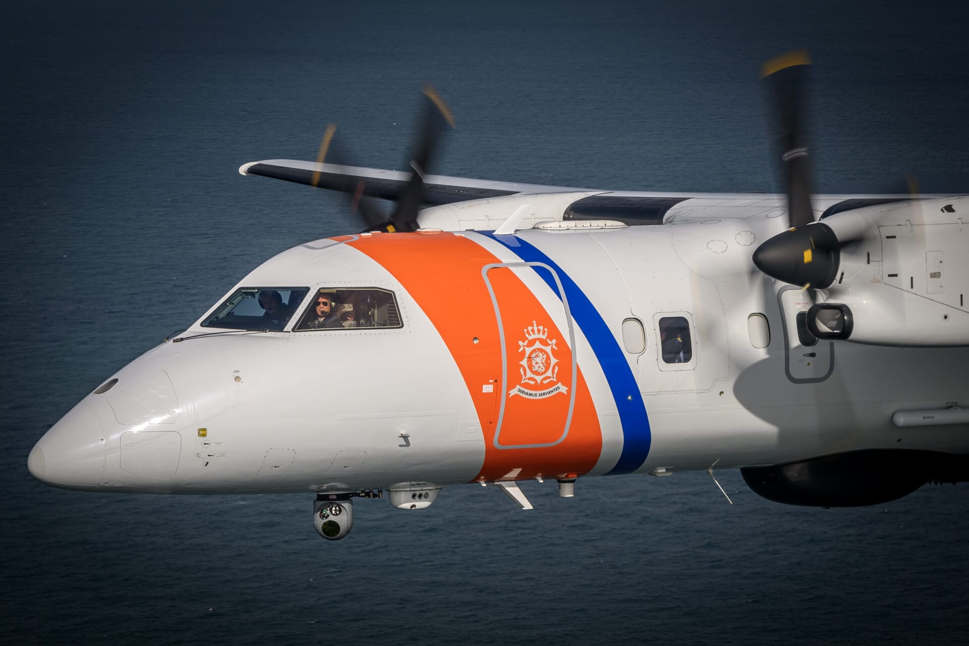
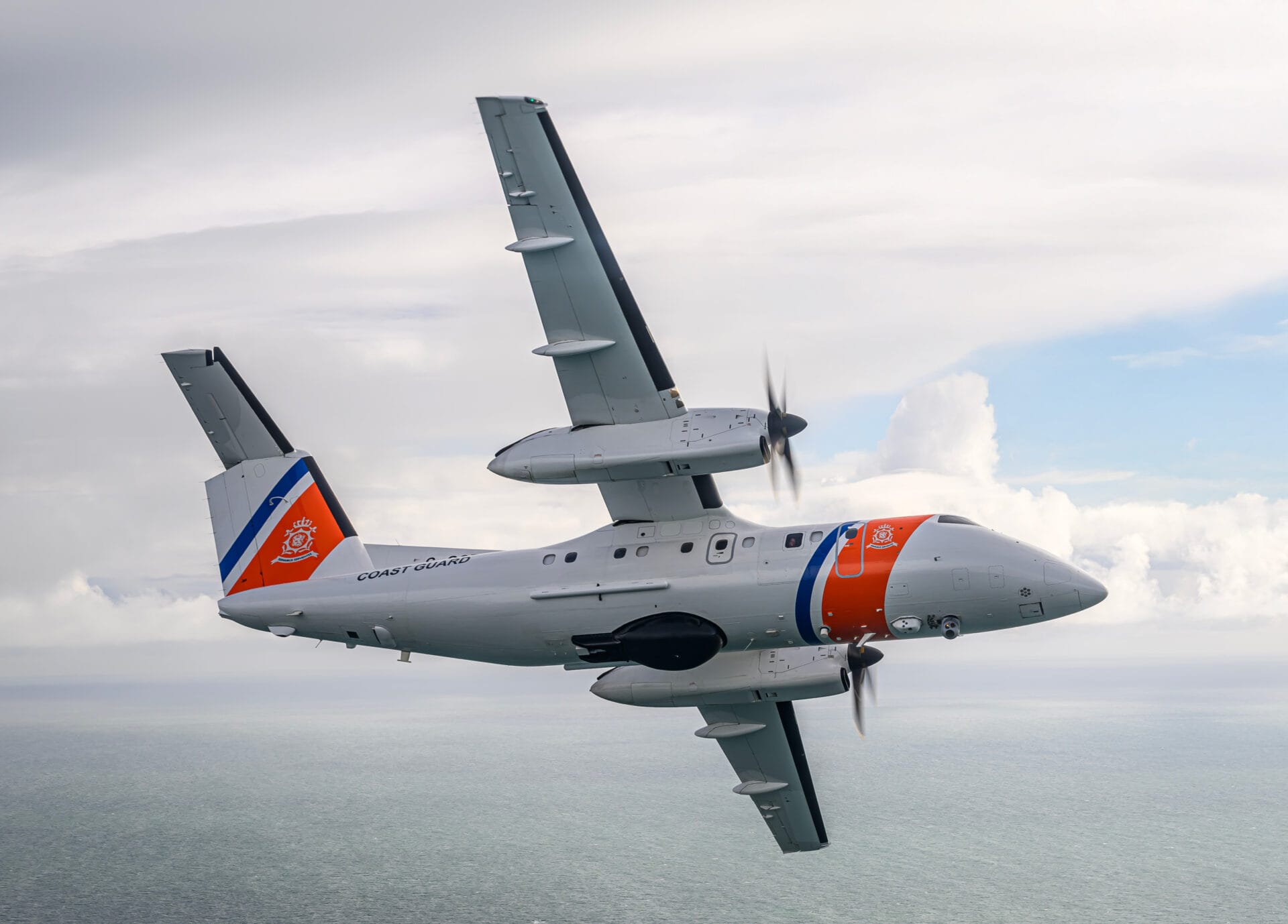
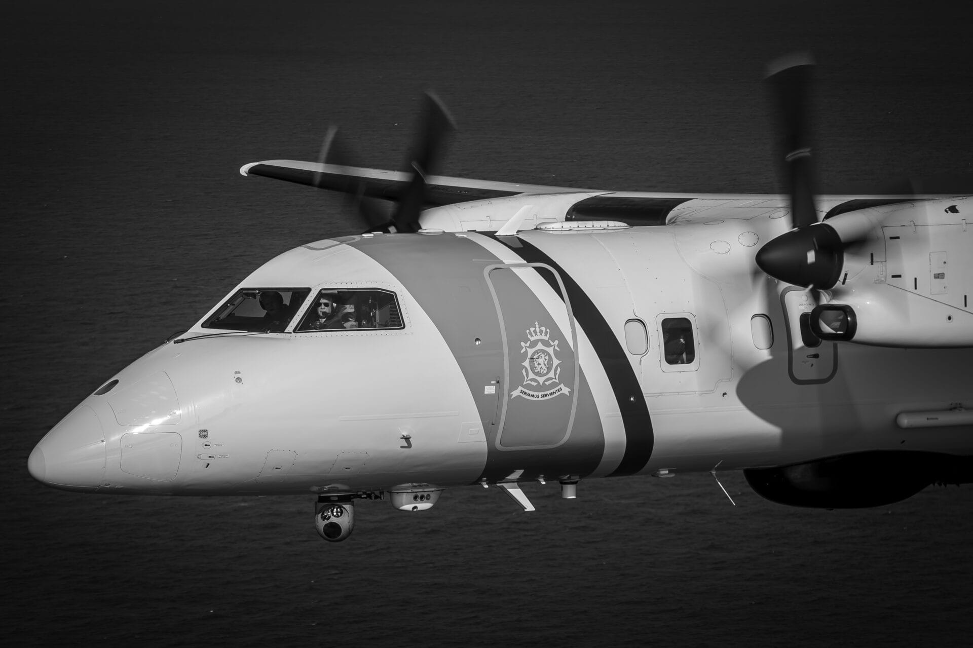
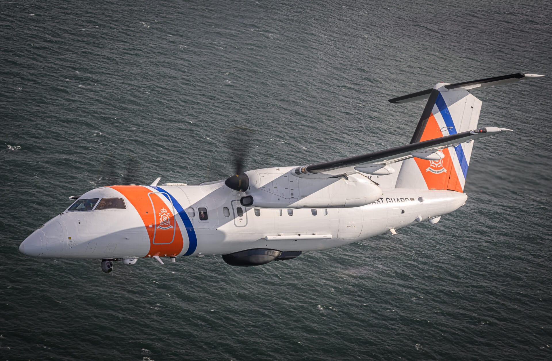
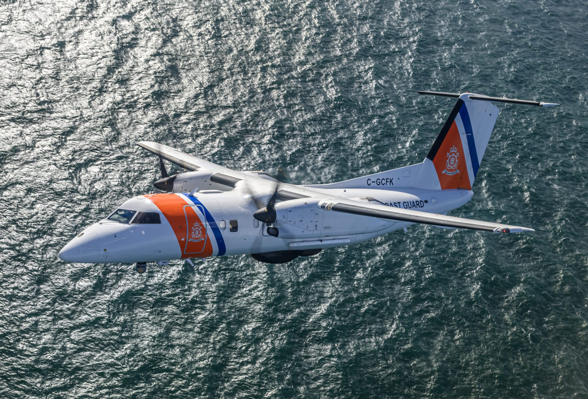
The PAL Dash-8s represent a generational leap from the NLCG’s legacy Dorniers, combining Side-Looking Airborne Radar (SLAR) persistence with 21st-century multispectral precision. Blankenstein emphasizes the new systems’ operational impact: “With the Dash-8’s sensors, our maritime picture of the North Sea increased by 80%. Before, we only saw what was physically visible. Now, we detect threats 100 nautical miles out.” While retaining the SLAR’s broad ocean sweep capability, the Dash-8 introduces the ELTA inverse synthetic aperture radar (ISAR) to scrutinize vessel profiles at standoff ranges, converting ambiguous radar returns into actionable intelligence. 

Camfferman agrees that the arrival of the PAL Dash-8s marked a turning point in operational competency. “The difference between the Dash-8 and the Dornier is significant; the sensors on board are much more sophisticated… But the platform itself changes how we operate”. 

Unlike the legacy Dornier, which had a limited endurance of 4 hours, the Dash-8 can fly for 8 hours. Its pressurized cabin and operating capability allow crews to loiter at higher altitudes to monitor ships covertly while reducing fatigue. 

This physical capability is backed by intense technological integration. Michel Versteeg, Managing Director of ISR Support Europe, attributes this success to PAL’s vertical integration. “We’re a one-stop shop on many levels… A single accountable partner that eliminates the delays and finger-pointing often found in multi-vendor ecosystems. This end-to-end oversight allows NLCG to bypass traditional procurement silos, ensuring seamless system interoperability and faster adaptation to evolving threats.” 

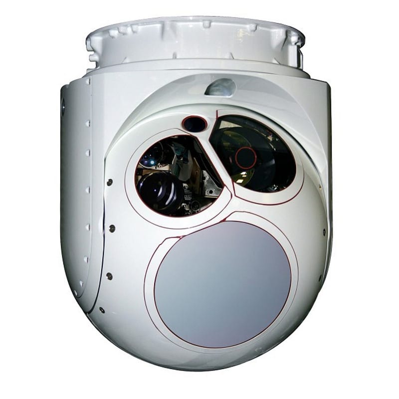
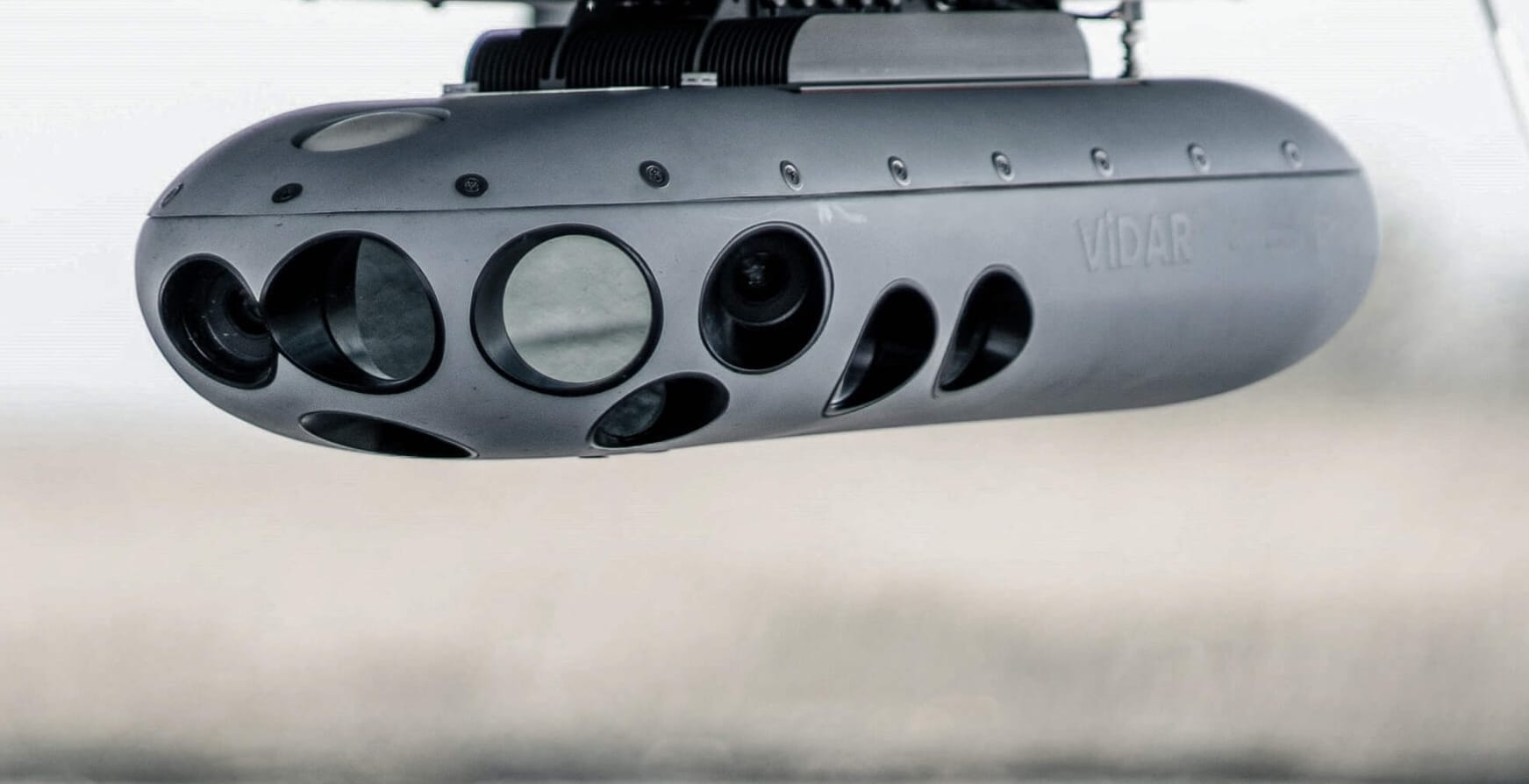
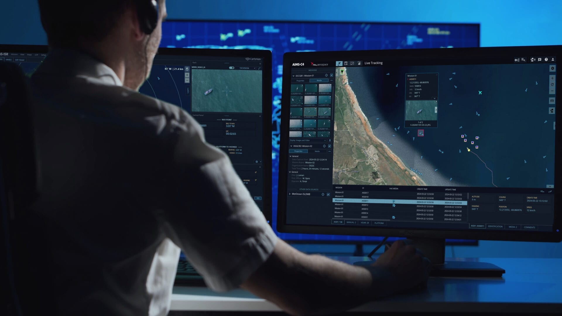
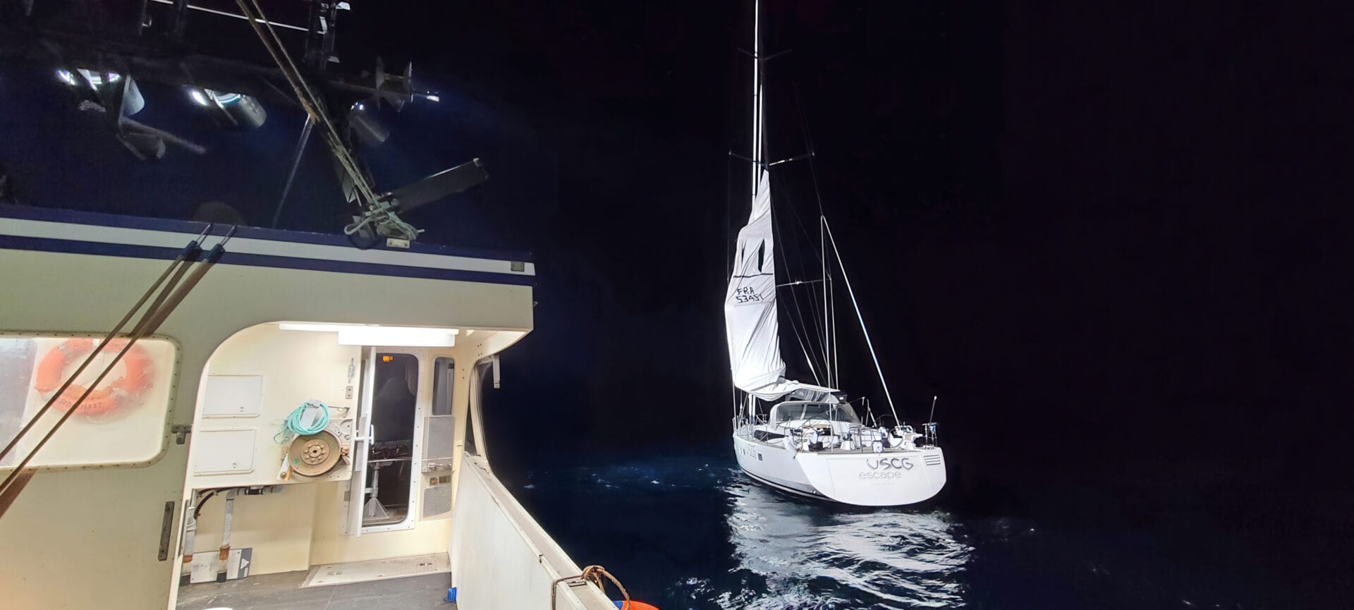
A prime example is the integration of CarteNav software, which aligns the aircraft’s ViDAR optical system with the WESCAM MX-15 camera. The ViDAR system uses AI-driven analysis to autonomously scan 10,000 km² every hour, instantly flagging small objects like life rafts. Once a target is spotted, the software automatically directs the camera to the location, delivering forensic-grade imagery, such as hull serial numbers or thermal signatures, without the technical lag of disjointed systems. 

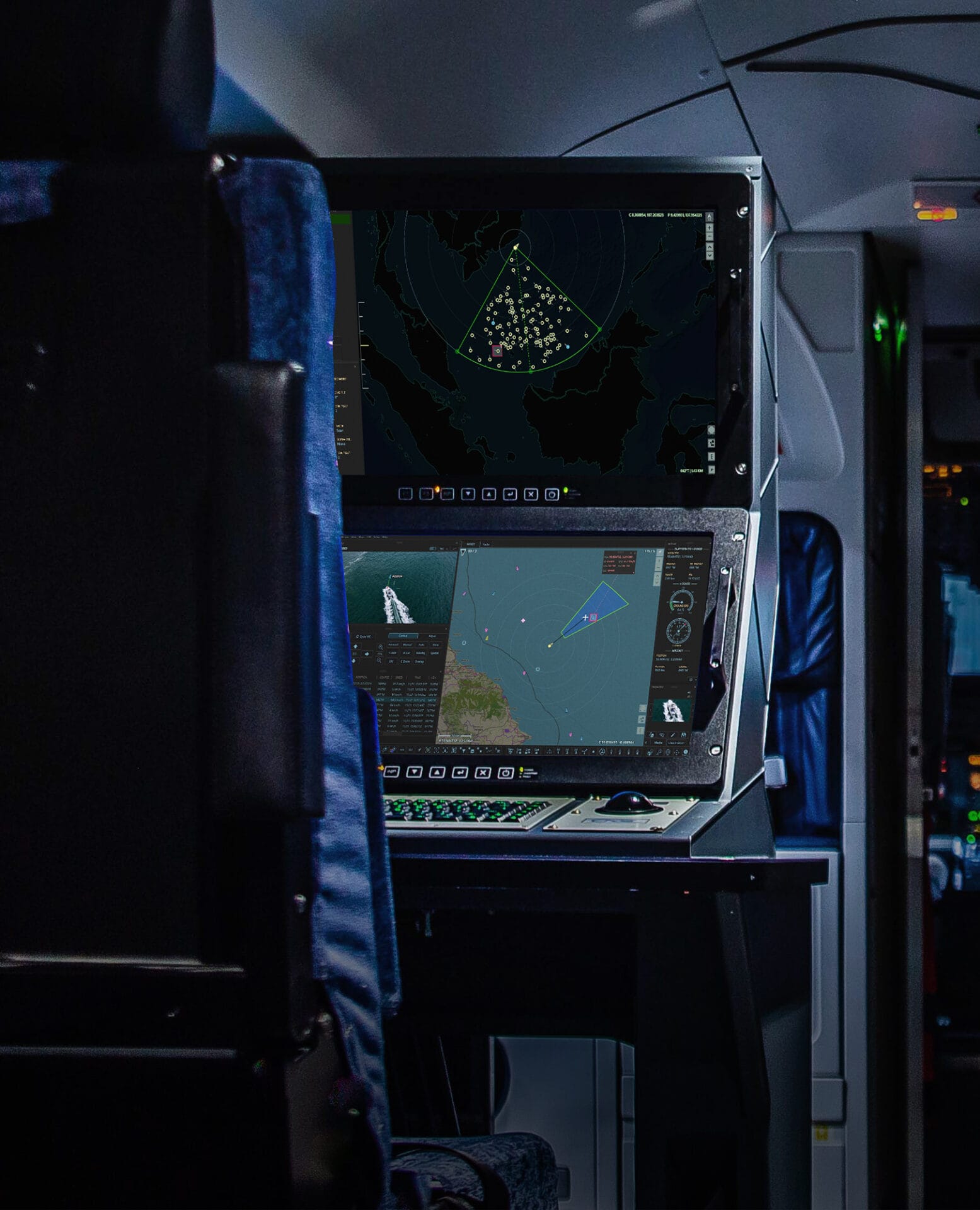
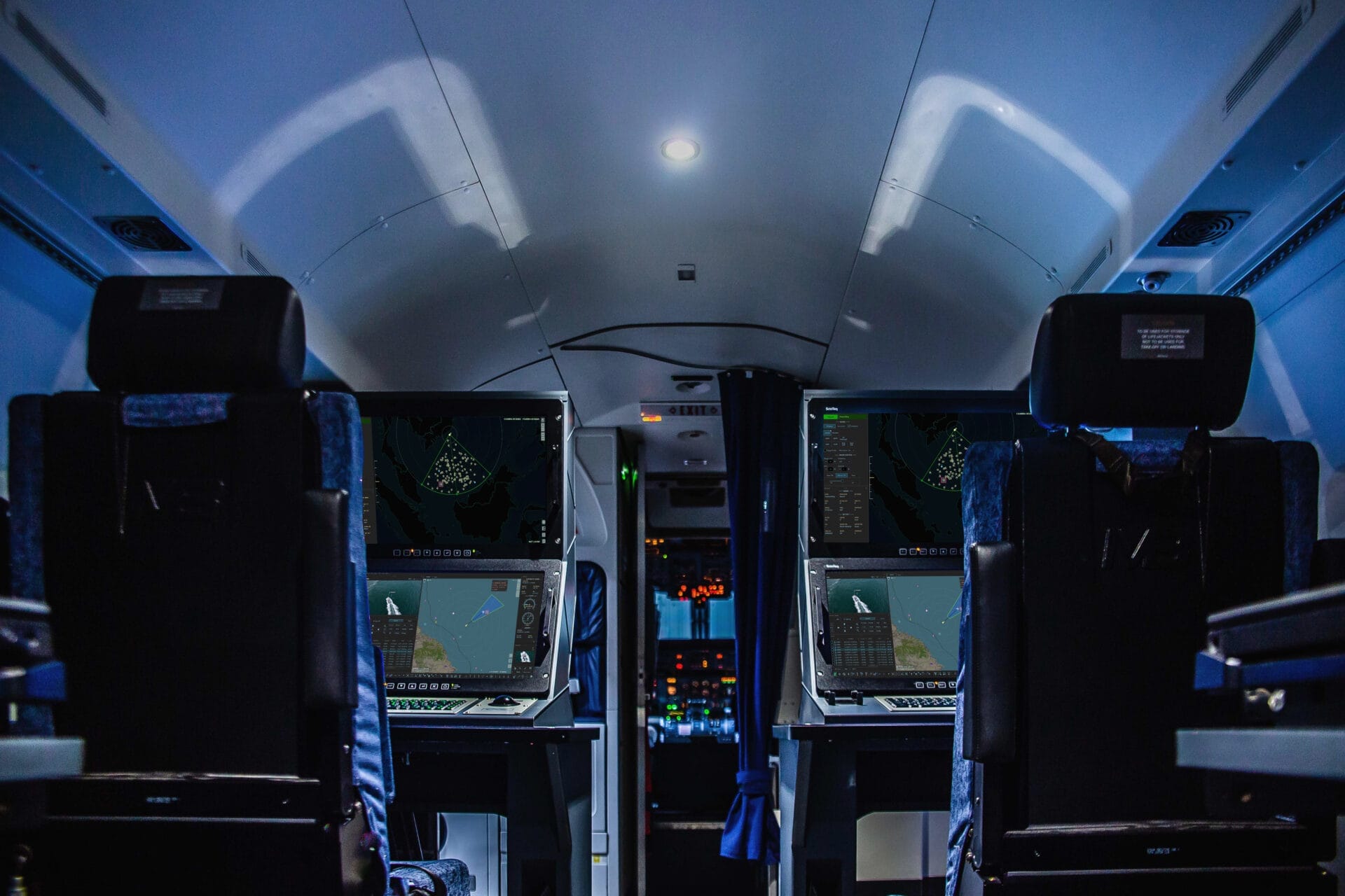
Meanwhile, the aircraft’s Iridium and Aspire dual satcom nodes and NATO-certified datalinks fuse this intelligence into stakeholder networks in near-real time, while its modular payload bay enables rapid deployment of liferafts, sonobuoys, or survival kits for search-and-rescue – a closed-loop capability chain few contractors can match without third-party dependencies. 

Securing the Domain: Infrastructure & Anomaly Detection

The sophisticated sensor suite does more than track known traffic; it identifies the “ghosts” that threaten safety and critical infrastructure. In a crowded sea filled with wind farms and data cables, a vessel running “dark” (without an automatic identification signal) presents a severe collision risk and a security challenge. 

This was validated during a patrol beneath a heavy cloak of fog. Mission Commander Blankenstein watched thousands of ship transponders move across his screen until one anomaly stood out: a radar contact 50 nautical miles off the patrol track with its identity scrubbed. 

Activating the new inverse synthetic-aperture radar (ISAR), Blankenstein narrowed the radar’s beam to a focused spot, cutting through the murk to reveal a 135-meter triangular silhouette. As the Dash-8 descended, its WESCAM cameras confirmed the anomaly: a Russian Admiral Gorshkov-class frigate transiting through Dutch waters without broadcasting its position. 

“That frigate’s AIS was dark, and its course was erratic. Without the radar upgrade, we’d have missed it completely”, explains Blankenstein. 

By documenting the vessel’s electronic signature and feeding the data directly to the interagency coordination center, the crew ensured all six ministries maintained situational awareness of the non-compliant vessel. “That was my first success story with our new advanced ISR platform capabilities” Blankenstein notes, highlighting how the system protects the North Sea from all forms of unmonitored traffic. 

Operational Agility: Serving Six Ministries

The Netherlands Coast Guard’s (NLCG’s) partnership with PAL Aerospace exemplifies agile surveillance amid competing priorities. Despite supporting six different ministries—including Defense, Justice & Security, and the Environment—the contract’s true strength lies in its flexibility. 

Blankenstein explains: “If there is new information about a specific area, we change routing instantly. We all understand our priorities.” He contrasts this efficiency with other European models: “I was in Southern Europe recently… every agency has separate airplanes, helicopters, and ships, and we operate two aircraft for six ministries!” 

This cost-effective, seamless cooperation was demonstrated during a recent human smuggling incident. During a standard patrol, the crew spotted an aging sailing vessel with no identification signal. When they flew a low pass just 300 feet overhead, the helmsman refused to look up, an unnatural behavior that signaled illicit activity. The aircrew guided a Coast Guard patrol boat to the scene, where officers discovered 10 illegal migrants concealed below deck—a successful intervention made possible by the tight link between the aircraft and the coordination center. 

European Frontiers: Balancing Vigilance and Rescue

The Dash-8’s capabilities extend beyond the North Sea. Twice a year, the NLCG deploys to the Mediterranean to support Frontex. Operating out of Catania, Italy, the aircraft patrols a massive sector spanning Sicily, Greece, Malta, and Albania. The primary challenge in this region is the sheer scale of the ocean versus the size of the targets. 

Using the new sensor suite, the crew can sweep this entire area in just four hours—a feat impossible with legacy equipment. This precision allows the NLCG to distinguish minute targets, such as plastic fish traps, from contraband drops in the dark. 

However, the mission often pivots from border enforcement to humanitarian rescue. Migrant smugglers frequently utilize small, 10-meter rubber dinghies or poor-quality polyester boats launched from North Africa. These vessels are often dangerously overcrowded and difficult to detect in open water. In one notable instance, the Dash-8’s radar located a group of small, unseaworthy migrant vessels in distress. Acting as an on-scene coordinator, the aircrew directed international rescue boats to the precise coordinates, ensuring that the interception led to the safe evacuation of survivors. 

Environmental Stewardship: Deterrence & Action

Beyond safety and security, a critical pillar of the NLCG mission is environmental protection. The mere presence of the surveillance aircraft has created a tangible deterrent effect against illegal dumping. 

“In the past we had much more pollution than nowadays, which I believe is due to most ships knowing that we are watching them,” notes Camfferman. This vigilance is powered by the Dash-8’s advanced SLAR sensors, which allow the crew to detect oil on the water surface with high precision. 

When pollution is detected via the Dash-8’s sensors, the response is methodical. The aircrew interrogates the vessel via VHF while simultaneously gathering evidence for prosecution. In cases of significant spills, the aircraft shifts roles to coordinate government recovery vessels. As Camfferman summarizes, the mission is vital for “showing the flag and letting crews know that we are watching them.” 


A Culture of Commitment

While the technology is impressive, the program’s ultimate success depends on the people who operate it. Overcoming the initial cultural shift from military to commercial management required dedication from both PAL Aerospace and the Coast Guard crews. Today, that friction has been replaced by a unified operational culture. “We have a good relationship with PAL” Blankenstein confirms. “Although we all have different backgrounds, we’re cross-trained in each other’s fields and have a ‘can-do’ mentality.” 

This professional synergy ensures that the NLCG is prepared for the future. Whether adapting to new smuggling tactics, integrating emerging sensors, or responding to the next major maritime emergency, the team is ready. As PAL Aerospace and the crews continue to enhance the Dash-8’s maritime surveillance capabilities, the partnership with the NLCG provides a proven blueprint for modern maritime domain awareness—agile, efficient, and vigilant. 

From the Fleet
[01 - 05]
MX-15 EO/IR
The MX-15 provides long-range EO/IR surveillance.
[02 - 05]
ELTA ISAR Radar
ELTA Systems ELM-2022 Airborne Maritime Patrol Radar enhances maritime surveillance.
[03 - 05]
ViDAR Wide Area Optical System
Passive wide area search for every mission.
[04 - 05]
Observer Window
Extra large window provides visual surveillance for operators.
Photograph of an AIMS-ISR workspace on an aircraft
[05 - 05]
AIMS-ISR Mission Software
AIMS-ISR powers the fleet with integrated, real-time multi-sensor intelligence.
NLCG DHC-8-100 MSA at a Glance
Max Range: 1,300 NM
Max Endurance: 8 Hours
Max Cruise Speed: 240 Kts
Surveillance Altitudes: 500-20,000 ft
AIMS-ISR Mission Software
The Netherlands Coast Guard relies on AIMS-ISR for multi-sensor control, geo-referenced moving maps, evidence reporting, SIGINT, custom mapping and more.
Operator at work station in command and control room.
AIMS-C4 Common Operating Picture
The Netherlands Coast Guard manages missions for the intuitively powerful web interface. AIMS-C4 allows real-time communication and data sharing between operators, analysts, and decision makers.
Case Studies
More Case Studies